Students engaged in Design and Technologies are asked to engage in complex analysis and problem-solving. The use of diagrams, images and other visual texts can support students to visualise, develop and plan solutions to problems. Traditional written communication does not enable students to develop multimodal communication skills, nor does it support students to explore the potential of technology to solve problems or meet specific needs (Serafini, 2014).
The strategy below engages students in
visual literacies and communications skills that are essential to effective design and problem-solving. It demonstrates how teachers can support students to construct visual representations to support the design process and then to develop project plans. The strategy can also be adapted so that students can work collaboratively online, using an online diagram creating tools such as Google Drawings.
The example draws on a real location, but the problems noted have been created for this task. However, a large number of local environmental groups exist in Victoria. Schools can contact these groups and students may be able to work with locals to negotiate a solution to a local problem, providing a real-world context for this activity.
- In a small group, students are to design a solution to the problem.
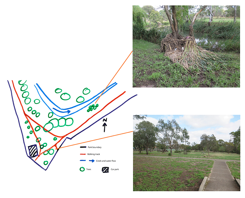
- For example,
The Friends of Kororoit Creek are a group of volunteers who are working towards restoring the Kororoit Creek corridor. They want to petition the Brimbank City Council to redevelop a section of the creek. The section of the creek has a bend where debris often collects, and after heavy rainfall, small plants get washed away. There is also a large space nearby, with few large trees, and a carpark. The Friends of Kororoit Creek have asked the students to design a solution to resolve the issues associated with debris and also to utilise the large space better.
- The teacher presents visual representations of the problem, explaining the elements of each.
- For example, the teacher may present a map of the area, explaining the legend, that has associated photographs that depict the problems.
- The teacher supplies a copy of the visual representation to students, and students draw and annotate their solution.
- Students explain their annotations to one another, providing feedback on both their visual representations and designed solution.
- In groups, students select the designed solutions they wish to implement.
- Students generate a plan to implement the proposed solutions, including:
- timeframe
- implementation process
- risk and safety factors to be considered.
Content descriptions for the above example:
VCDSTS043,
VCDSCD050,
VCDSCD053,
VCDSTS054,
VCDSCD061,
VCDSCD064.